
The Bismark Ranger Station at Bismark Meadows no longer exists, as it did when this photo was taken about 1925. It became the Priest Lake Ranger Station when district headquarters were relocated to the present site, about four miles south, on Highway 57 at Nordman. The log building was the cook house.

This Economic Recovery Act camp was a make-work camp established north of Priest River during the depression. It could have been located on Stone Johnny or in the Four Corners area close by – accounts differ.
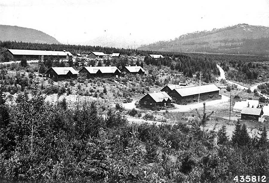
H. Miller Cowling took this photograph at Kalispell Bay, Priest Lake, sometime in the mid-1930s, judging by the size of the trees, which were planted after the 1926 fire. The camp that is shown began as a Civilian Conservation Corps camp in 1933 or 1934, and became the Blister Rust Control headquarters at Priest Lake in 1936. The program was first administered by the Bureau of Entomology and Plant Quarantine, but was taken over by the Forest Service after 1950. The Blister Rust control program was phased out in 1967.

This was The Falls Ranger Station at Torelle Falls, a few miles north of Priest River, as it looked in the 1930s. The station was phased out in 1973.
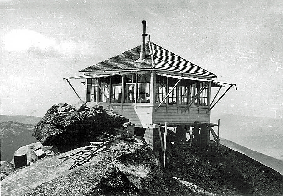
This photograph of the Squawman Lookout in the Priest Lake country was taken in 1937.
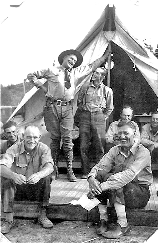
Big Creek CCC tent crew: Leo Black, foreman, in front of tent pole, looking up at Tiny Paige; Pete Hirst, another foreman, in back sitting, on far right edge of photo. Others are unidentified.
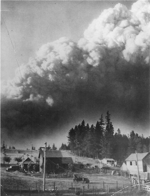
In August 1931 a forest fire possibly caused by lightning (or maybe, some said, by an overturned still) broke out at Freeman Lake and roared across the Peninsula north of Priest River at incredible speeds, whipped by wind. This worst natural disaster ever to befall the Priest River Valley claimed no lives but caused much damage to property. The Leonard Brown farm on the outskirts of Priest River was far enough away that it escaped the flames.

An island of green trees survived the 1926 and 1939 burns in the Priest Lake area. A notation on the back of the photograph gives Kalispell and Deerhorn Flats as the location.
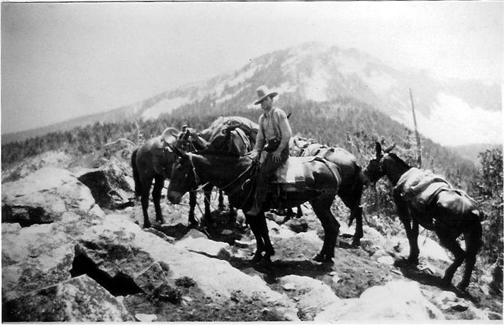
Barney Stone and pack mules are shown in this photograph high up in the Selkirks.
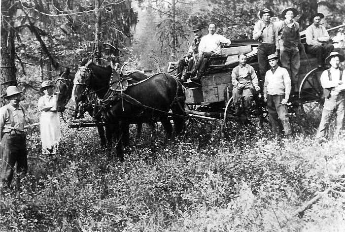
The Intermountain Forest and Range Experiment Station north of Priest River has pioneered much forest and wildfire research over the years. This photo shows the people who established the station in August 1911. Those who have been identified include Raphael Zon, chief of silviculture, Washington, D.C., fourth from left; and Donald Brewster, first director of the station, sixth from left.